Stories
Here we present some of the user stories based on real tracks done with LocaToWeb. The intent is to show possibilities through visual examples and actual usage. This app is made for the outdoor adventurer that like to go places and still feel safe.
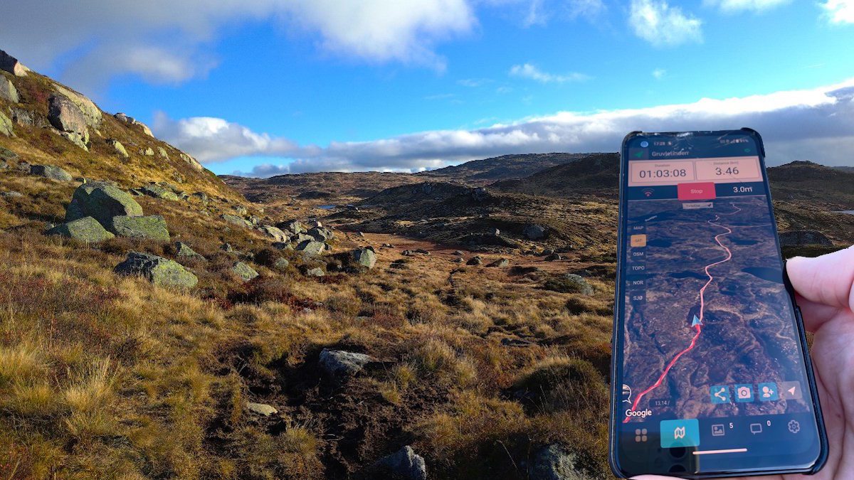
Late fall mountain hike to Gruvletinden with GPS tracker
It's late in the fall and the last chance to reach this peak before the snow comes and the road close for the winter. The GPX route has been loaded into the app, so the navigation is easy.
It's late in the fall and the last chance to reach this peak before the snow comes and the road close for the winter. The GPX route has been loaded into the app, so the navigation is easy.
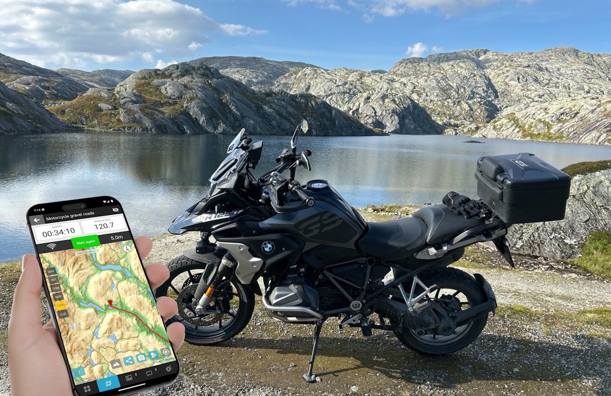
Long distance motorcycle ride on gravel roads in the mountains
The BMW R1250GS is built for long-distance travel, mountain roads and gravel. Taking it for a ride in the norwegian mountains is the best feeling in the world.
The BMW R1250GS is built for long-distance travel, mountain roads and gravel. Taking it for a ride in the norwegian mountains is the best feeling in the world.
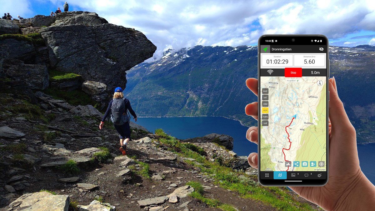
Dronningstien Hardanger - A walk on the edge with spectacular views
The hike starts with a long steep climb from Kinsarvik,which is a popular starting point. When completing the hike in Lofthus the last section is between rows and rows of apple trees and makes a perfect end to the hike.
The hike starts with a long steep climb from Kinsarvik,which is a popular starting point. When completing the hike in Lofthus the last section is between rows and rows of apple trees and makes a perfect end to the hike.
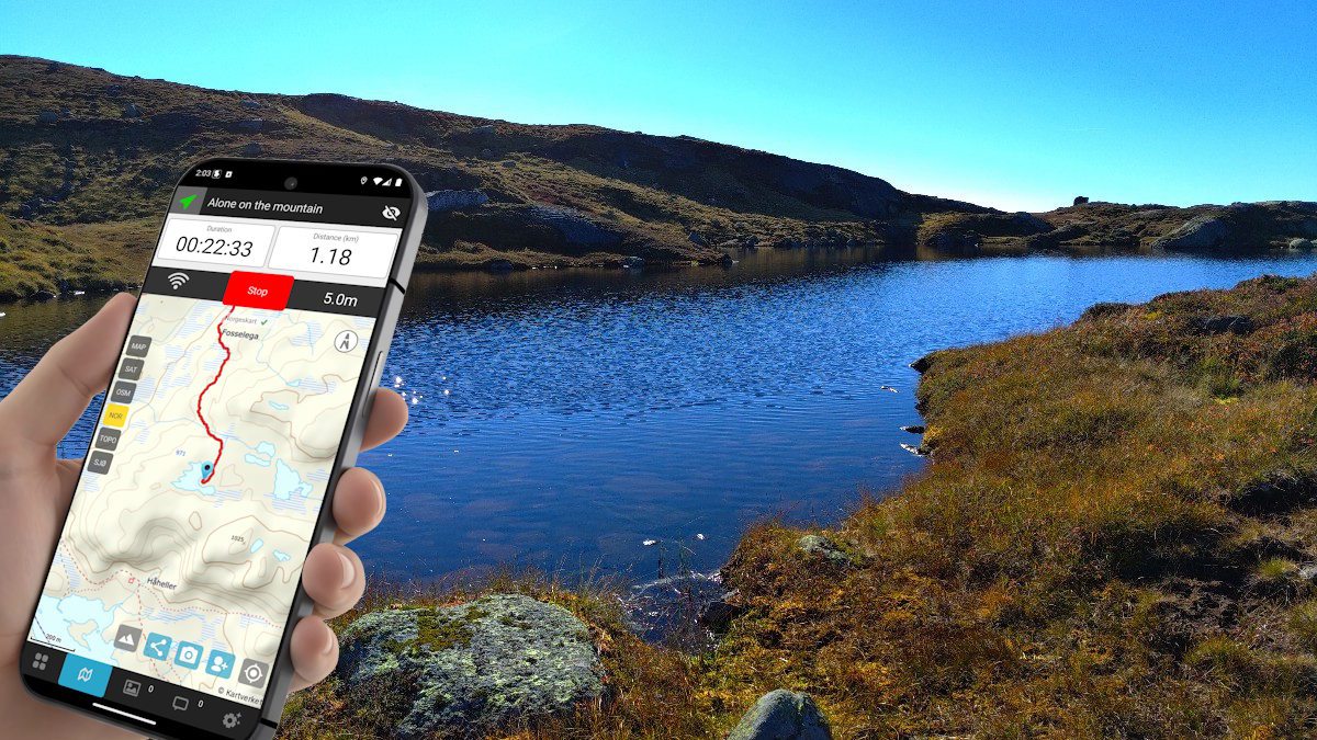
Hiking alone in the mountain with tent and sleeping bag
When out alone in the nature far away from people I always use LocaToWeb for navigation purposes and to let my family know where I am. This time it came to the rescue.
When out alone in the nature far away from people I always use LocaToWeb for navigation purposes and to let my family know where I am. This time it came to the rescue.
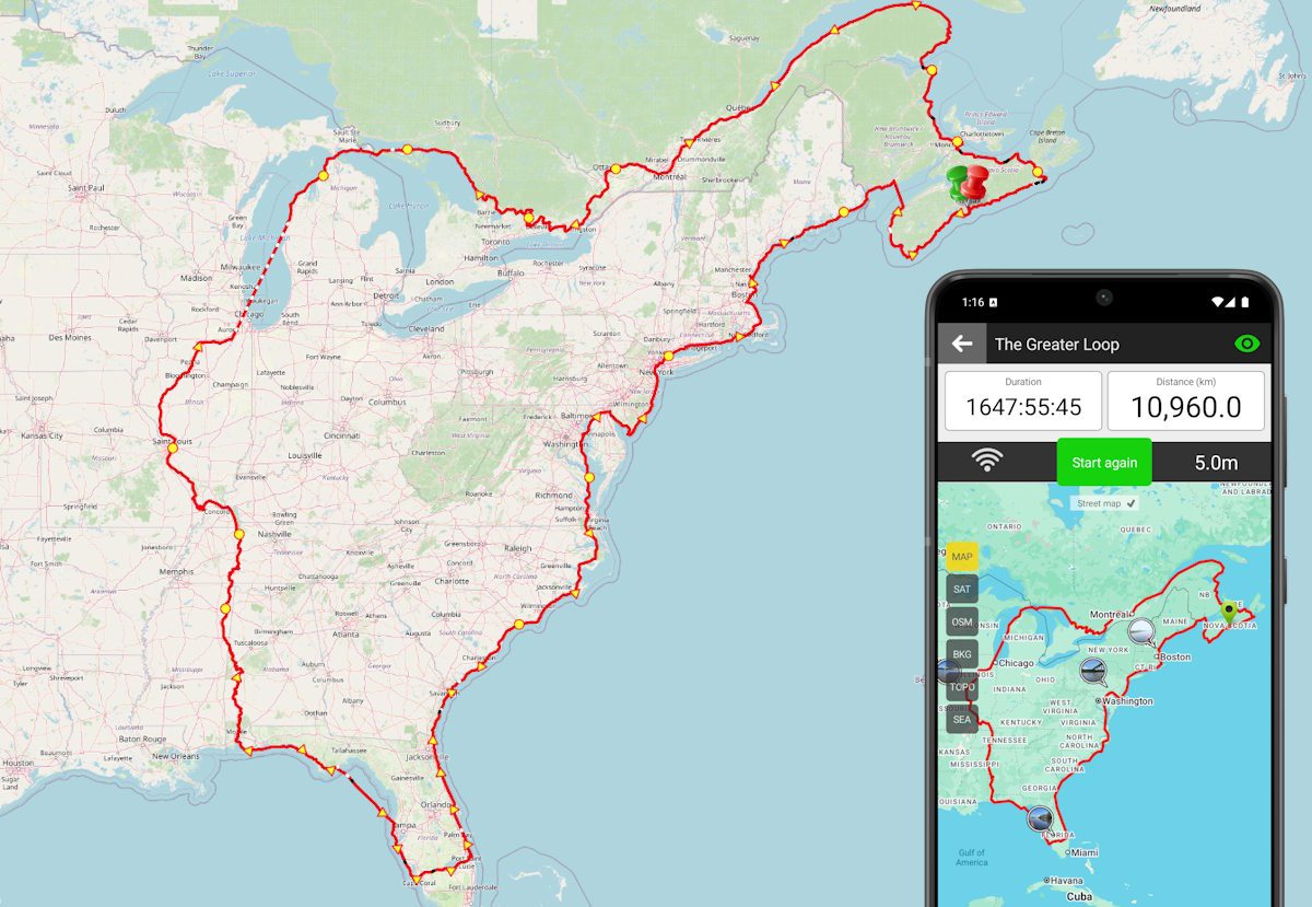
The Greater Loop - A 10,500 km solo kayak expedition
The Great Loop is a continuous waterway that allows boaters to explore Eastern North America. This guy did it with a kayak.
The Great Loop is a continuous waterway that allows boaters to explore Eastern North America. This guy did it with a kayak.
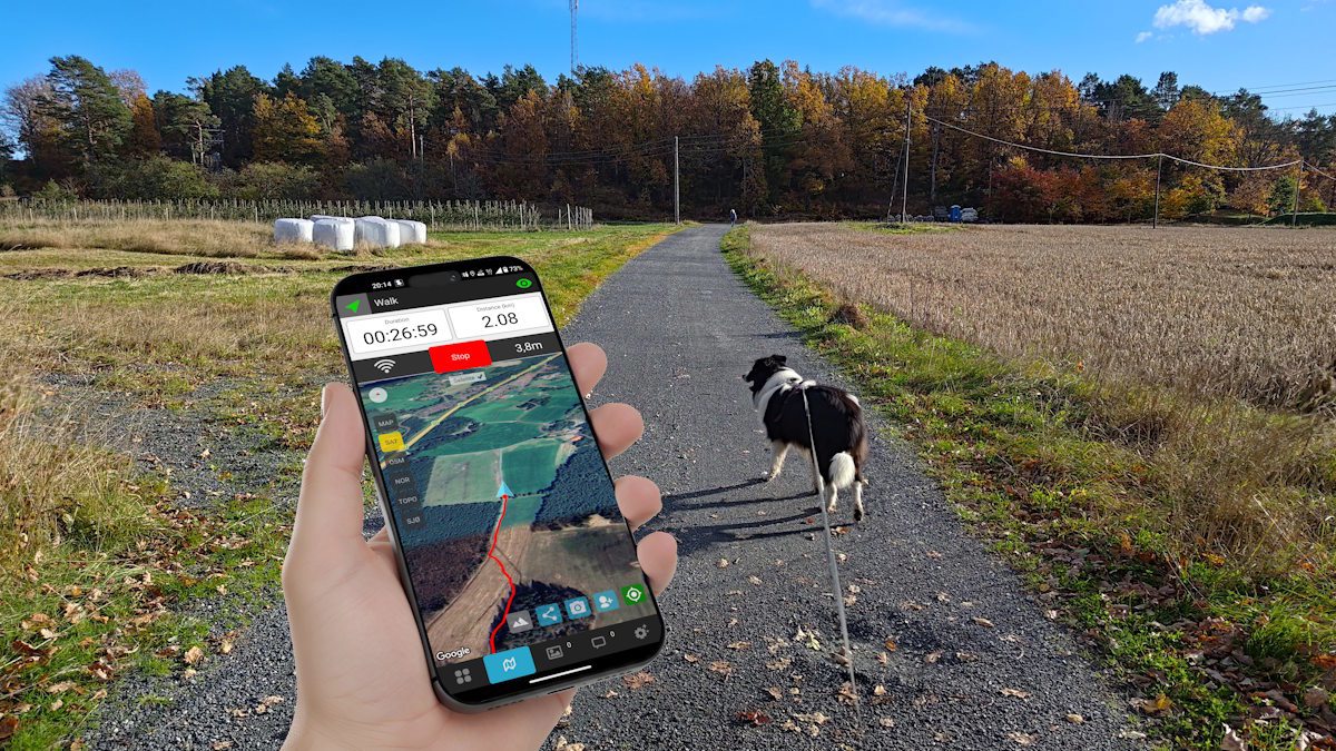
Walking the dog on a beautiful day in autumn with GPS tracking
The dog must be exercised every day and I always track the walk. This day I was at an unfamiliar location, and the app is great to use for navigation. There are several maps to choose from.
The dog must be exercised every day and I always track the walk. This day I was at an unfamiliar location, and the app is great to use for navigation. There are several maps to choose from.
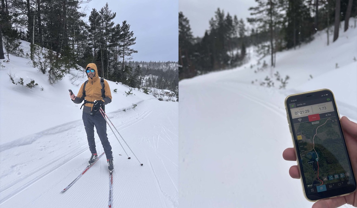
Cross country skiing with LocaToWeb on a gray and windy day
It is Sunday morning and a great day for 10km of cross-country skiing despite the cold wind and grey weather. Hands are freezing cold and the hood is on.
It is Sunday morning and a great day for 10km of cross-country skiing despite the cold wind and grey weather. Hands are freezing cold and the hood is on.
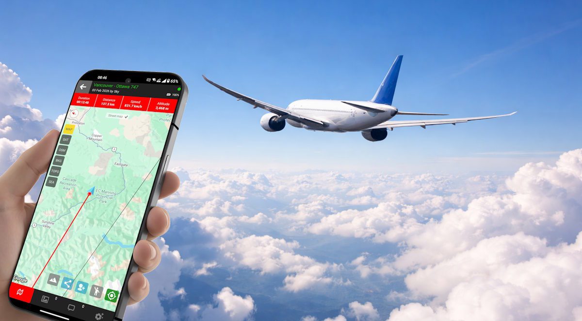
Real time GPS tracking an airplane at 30.000 feet - no problem
LocaToWeb is crusing at 30,000 feet in an airplane. Real time GPS tracking works well in these altitudes as long as there are internet connection on board.
LocaToWeb is crusing at 30,000 feet in an airplane. Real time GPS tracking works well in these altitudes as long as there are internet connection on board.
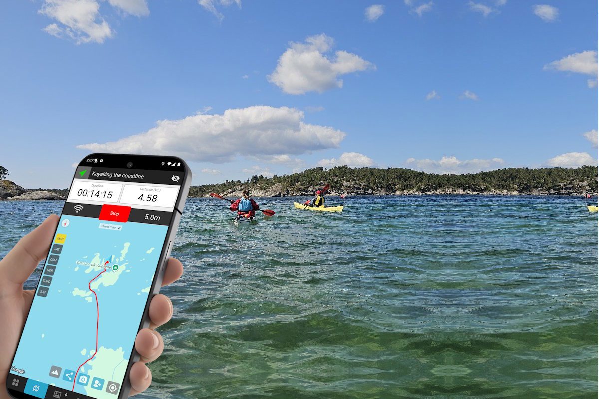
Kayaking the coast with friends - Feeling safer with GPS tracking
It was a nice day for some kayaking with friends from the local club. We started early in the day paddled more than 100 km.
It was a nice day for some kayaking with friends from the local club. We started early in the day paddled more than 100 km.